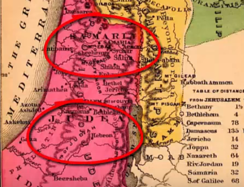
Old maps reveal that ‘Palestine’ has historically been used as a geographical term, not as the name of a nation or state.
After the failed rebellion of Bar Kokhba in the Second Century CE, the Roman Emperor Hadrian assigned the name Palastina, for administration purposes, to the region that was formerly the Kingdom of Judea, in an attempt to disconnect the land from its Jewish past.
Indeed, the Palestine Liberation Organization (PLO), formed in 1964, did not seek to liberate the Arabs in ]Judea and Samaria (the West Bank) and Gaza. At that time, they were considered Jordanian and Egyptian Arabs, respectively.
Take a look at how maps long predating the PLO show the truth of the Jewish connection to the land.
WATCH: Exposed – What those Old ‘Palestine’ Maps Really Show!
